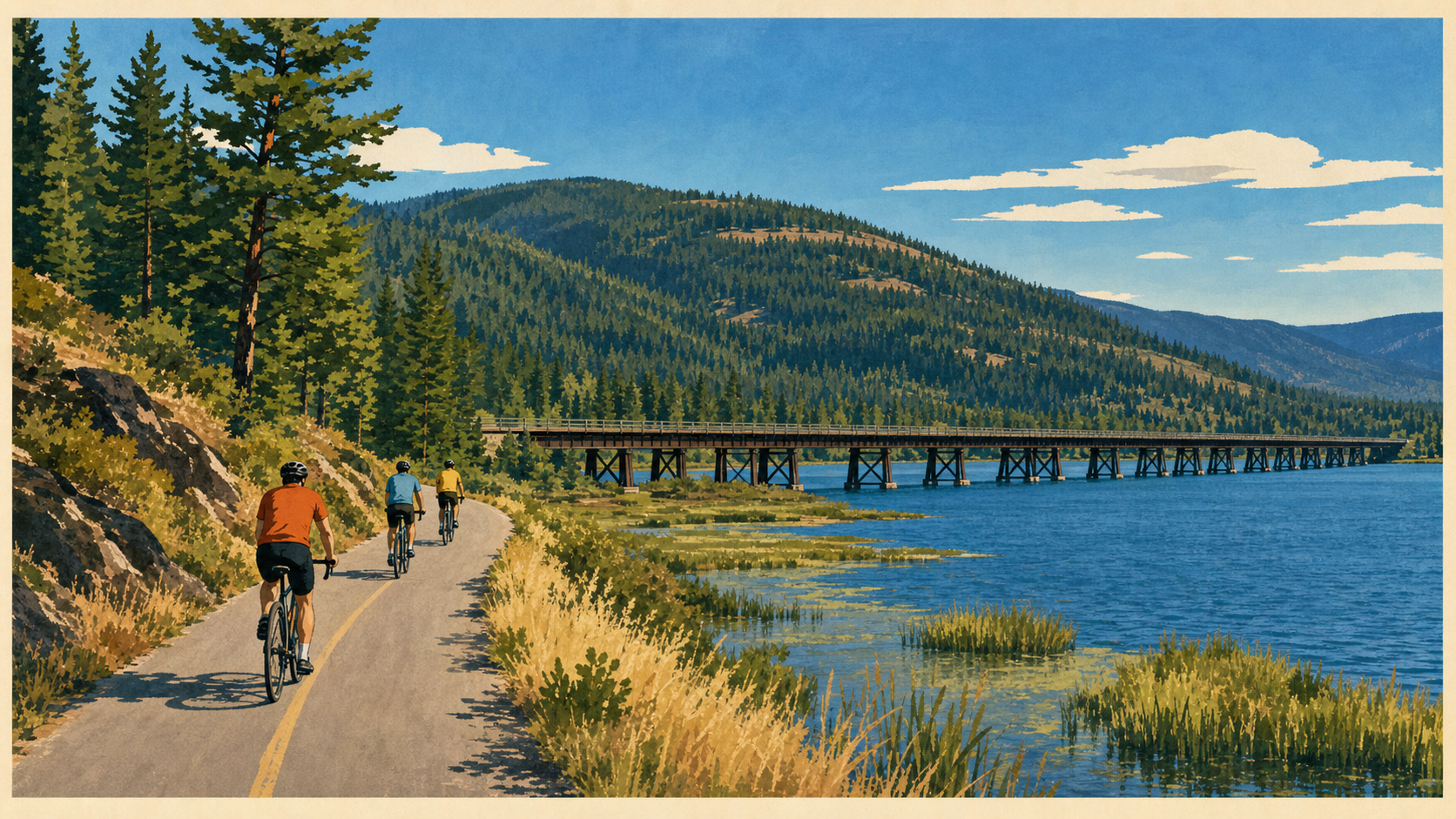
Trail of the Coeur d'Alenes from St. Maries: Trailheads, Best Sections, and First-Timer Tips
How to ride the Trail of the Coeur d'Alenes from St. Maries — which trailheads to use, the best beginner sections, and what first-time riders should know.
The Trail of the Coeur d'Alenes is a paved rail trail running about 73 miles across the Idaho Panhandle, from Plummer in the west to Mullan near the Montana border. It's flat, smooth, and genuinely suitable for beginners — one of the best family cycling routes in the Northwest.
It does not pass through St. Maries. Any ride from here starts with a drive, and the two nearest access points are the Plummer trailhead and the trail sections inside Heyburn State Park. That's the single most useful thing to know before you load bikes, because plenty of listings suggest otherwise.
The good news: the section closest to St. Maries — Heyburn out to Harrison, crossing the Chatcolet Bridge — is widely considered the best stretch of the entire trail.
What the trail actually is
The trail follows the abandoned Union Pacific right-of-way, a rail line built through the Silver Valley for the mining industry and abandoned in 1991. It opened as a trail in March 2004, created through a partnership between the Coeur d'Alene Tribe, Union Pacific, the federal government, and the State of Idaho.
Running west to east, the route climbs out of Plummer on the Palouse prairie, drops through forested Plummer Creek canyon into Heyburn State Park, crosses the water on the Chatcolet Bridge, follows the shore of Lake Coeur d'Alene to Harrison, then turns up the Coeur d'Alene River past a chain of lakes and marshes before climbing the Silver Valley to Mullan.
Key facts:
- About 73 miles, paved asphalt throughout. Source figures vary slightly — 72 to 75 — depending on how the ends are measured.
- 20 developed trailheads and 20 scenic waysides with tables and benches.
- Very gentle grade. Total elevation change is around 1,200 feet, nearly all of it at the far eastern and western ends. The average grade is roughly 1%.
- Class 1 and 2 e-bikes are permitted.
- Open year-round, and used in winter for snowshoeing and cross-country skiing.
- Dogs are welcome on leash.
- A posted speed limit applies — commonly cited as 15 mph. Watch for signage.
Management is split, which matters if you need to ask someone something: the Coeur d'Alene Tribe administers the 14.5 miles from Plummer to Harrison, and Idaho Parks and Recreation the remaining stretch to Mullan, with shared management through Heyburn State Park.
One thing every rider should know
The rail bed this trail sits on was built with mine waste rock and tailings containing heavy metals, and was further contaminated by ore spillage from passing trains over a century of operation. Idaho Parks and Recreation states this openly.
The thick asphalt surface and gravel barriers are engineered containment — they're designed to permanently isolate those contaminants. The trail is safe to use as intended.
What that means practically: stay on the paved surface. Don't dig, don't let children play in the soil or gravel beside the trail, and wash hands before eating. Use the developed rest areas. This isn't cause for alarm, but it is a real reason the "just stay on the path" rule matters more here than on an ordinary trail.
Getting there from St. Maries
There is no trailhead in St. Maries. Your two practical options:
Heyburn State Park — the closest access and the best starting point for most riders. The trail runs directly through the park, and you can be riding within a drive of well under an hour. Idaho charges a per-vehicle day-use fee, generally $7–$14.
⚠ Check the park's official page before you go. Idaho Parks and Recreation has posted work affecting parking and boat launch access at Chatcolet, which is exactly where most riders want to leave a car. Confirm current parking availability rather than discovering it on arrival.
Plummer trailhead — the western terminus, off Highway 95. A good option if you'd rather ride downhill toward the lake and back, since the Plummer end sits highest.
Further trailheads at Harrison, Bull Run, Cataldo, Enaville, Pinehurst, Silver Mountain, Wallace, and Mullan are all reachable as longer drives, mostly along the I-90 corridor.
Best sections for first-timers
Chatcolet to Harrison — the one to do
About 7.8 miles each way, roughly 15.6 miles round trip.
This is the highlight of the entire trail. You start in Heyburn State Park, cross the Chatcolet Bridge — a converted railway trestle about 3,100 feet long, with a gentle rise and fall built in for boat clearance — and then follow the shoreline of Lake Coeur d'Alene the whole way to Harrison.
There are three rest areas along this stretch, with restrooms at two and picnic tables at each. Harrison is a small lakeside town and a natural turnaround point.
Best for: anyone riding the trail for the first time, families with kids comfortable on a bike for a couple of hours, and photographers.
Indian Cliffs to Chatcolet — the short version
About 1.3 miles each way.
If you have young children, limited time, or just want to see the bridge, this is the minimum viable ride. The lake is on your right the whole way and there's a restroom at Chatcolet.
Plummer to Chatcolet — the longer prairie-to-lake run
About 7.5 miles each way (Plummer to Indian Cliffs is roughly 6.2 miles, then another 1.3 to Chatcolet).
This section follows Plummer Creek through a deepening canyon and thick forest before opening onto the lake. There are two rest areas with restrooms between Plummer and Indian Cliffs.
The catch: Plummer is the high end. Riding out is mostly downhill, which means the return is a steady climb. It's never steep, but on a hot afternoon with tired kids it's the direction of travel people underestimate. If in doubt, start at Heyburn instead.
Harrison to Springston
About 3.1 miles each way, with a rest area along Anderson Lake and a restroom in Springston. A good add-on if you've ridden to Harrison and still have energy.
Section planning table
| Section | One-way distance | Surface | Elevation feel | Facilities | Best for |
|---|---|---|---|---|---|
| Indian Cliffs → Chatcolet | ~1.3 mi | Paved | Flat | Restroom at Chatcolet | Small children, a quick look at the bridge |
| Chatcolet → Harrison | ~7.8 mi | Paved | Flat, lakeside | 3 rest areas, restrooms at 2 | First-timers — the best section |
| Plummer → Indian Cliffs | ~6.2 mi | Paved | Downhill out, uphill back | 2 rest areas with restrooms | Riders wanting a bit more effort |
| Harrison → Springston | ~3.1 mi | Paved | Flat | Rest area, restroom in Springston | Extending a Harrison ride |
Distances are approximate and drawn from published trail descriptions. Confirm against the official trail map before you ride.
What to bring
- Water. Rest areas have restrooms but don't count on drinking water.
- Layers. Lakeside wind can make a warm day feel cold, especially on the bridge.
- Sun protection. Long exposed stretches with little shade.
- A basic repair kit — tube, levers, pump, multitool. There are no bike shops on the trail.
- Lights if there's any chance of riding at dusk.
- Helmets.
- Snacks. Harrison has services; most of the trail doesn't.
On rentals: we're not naming a rental or shuttle operator, because we haven't verified one currently serving these trailheads. If you need bikes, arrange them in advance — check with Heyburn State Park and with shops in the Coeur d'Alene area — and confirm before you travel rather than assuming you can rent on arrival.
Etiquette and safety
- Keep right, pass left, and call out before passing.
- Watch your speed on descents and near rest areas. There's a posted limit.
- Stay on the pavement, for the containment reason above.
- Leash dogs and clean up.
- Yield to slower users. Families and young riders are common.
- The western section runs through the Coeur d'Alene Reservation. You're a guest — stay on the trail and respect posted rules.
- Wildlife. Moose are present in the marshy chain-lakes country. Give them a very wide berth.
- No cell service in stretches. Tell someone your plan.
Pairing a ride with a weekend
The trail fits neatly into a St. Maries stay as a half-day or full-day outing.
Half day: drive to Heyburn, ride Chatcolet out to the bridge and back, picnic in the park, home by mid-afternoon.
Full day: ride Chatcolet to Harrison and back — around 16 miles — with lunch in Harrison. Add time in Heyburn afterwards if anyone's still keen.
Either way, pack food. Kitchens in St. Maries close early, so a late return means cooking at the house. Our weekend guide to St. Maries shows how a ride day fits alongside a river day, and the day trips guide covers the other directions worth driving.
If you'd rather walk than ride, the easy hikes near St. Maries guide covers short forest and park routes, including the trails inside Heyburn.
Know before you go
- There is no trailhead in St. Maries. Plan to drive.
- Check current closures and parking with Idaho Parks and Recreation before setting out, particularly at Chatcolet.
- Check the official trail map for trailheads, waysides, and restrooms.
- Conditions change. Weather, closures, and maintenance all affect the trail. Nothing here is a condition report.
- Contact: Idaho Parks and Recreation for the Harrison-to-Mullan section and Heyburn; the Coeur d'Alene Tribe for the Plummer-to-Harrison section.
Frequently asked questions
Does the Trail of the Coeur d'Alenes go through St. Maries? No. The trail runs about 73 miles between Plummer and Mullan, following the old Union Pacific line through Heyburn State Park, along Lake Coeur d'Alene to Harrison, and up the Coeur d'Alene River to the Silver Valley. St. Maries is south of that corridor, on a different river. The nearest access points are the Plummer trailhead and the sections within Heyburn State Park.
What's the best section of the Trail of the Coeur d'Alenes? Chatcolet to Harrison, about 7.8 miles each way, is widely regarded as the finest stretch — it crosses the roughly 3,100-foot Chatcolet Bridge and then follows the shoreline of Lake Coeur d'Alene, with three rest areas along the way. It's also the closest good section to St. Maries.
Is the Trail of the Coeur d'Alenes suitable for beginners? Yes. It's paved throughout with a very gentle grade — total elevation change across all 73 miles is around 1,200 feet, and most of that is at the far ends. The middle and western sections near Heyburn are essentially flat, which makes them well suited to children and casual riders. Class 1 and 2 e-bikes are also permitted.
Are e-bikes allowed on the Trail of the Coeur d'Alenes? Class 1 and Class 2 e-bikes are permitted, per Idaho Parks and Recreation. A posted speed limit applies to all users — commonly cited as 15 mph — so watch for signage and moderate your pace near rest areas and crowded sections.
Can I rent bikes near the trail? Possibly, but arrange it in advance. We haven't verified a rental or shuttle operation currently serving the Plummer or Heyburn trailheads, so don't travel assuming you can rent on arrival. Check with Heyburn State Park and with bike shops in the Coeur d'Alene area before your trip.
Is the trail safe, given it was built on a former mining railway? Yes, when used as intended. Idaho Parks and Recreation is open about the fact that the rail bed contains mine waste with heavy metals, and that the thick asphalt and gravel barriers are engineered to permanently isolate it. Stay on the paved surface, keep children out of the soil and gravel beside the trail, use the developed rest areas, and wash hands before eating.
735 Elm Drive is a straightforward drive from the Heyburn and Plummer access points, with room to store bikes and gear between rides.